Heavy Rain, Storms Likely Tuesday Before Treasure Coast Pattern Eases
An 80% rain chance Tuesday afternoon gives way to drier conditions by Thursday — but the week opens wet
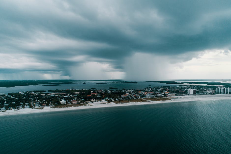
TODAY: Tuesday brings the kind of day that keeps boats in the slip and contractors checking their phones. Skies will be considerably cloudy through the morning, with showers and thunderstorms arriving late morning and growing more likely through the afternoon and toward sunset. Highs reach the mid-80s. South winds of 5 to 10 mph shift southeast with gusts up to 20 mph by late afternoon — the wind pickup arriving right alongside the heaviest storm threat. The rain chance is 80%, the National Weather Service said.
This week's setup echoes last May's persistent onshore flow pattern, which brought similar multi-day rain totals to the St. Lucie and Indian River Lagoon watersheds.
TONIGHT: Considerable cloudiness holds overnight with showers likely and thunderstorms possible in the late evening and early morning hours. Low temperatures settle in the mid-70s. Southeast winds of 5 to 10 mph ease to around 5 mph after midnight. The rain chance remains at 60%, forecasters said.
THIS WEEK: Wednesday offers modest improvement but no clear break — partly cloudy skies, afternoon showers and storms likely, and a 60% rain chance. Wednesday night dries noticeably, dropping to a 30% chance. Thursday is the week's best day: partly sunny, highs in the mid-80s, and only a slight storm chance late in the afternoon. The rain probability falls to 20%, according to National Weather Service data. Northwest winds shift northeast through the day Thursday, a signal the onshore flow pattern is beginning to relax heading into the weekend.
ON THE WATER: Tuesday is a stay-close-to-home day on the water. Southeast gusts to 20 mph will build a two- to three-foot chop on coastal waters by afternoon, and the storm threat through sunset makes any offshore push a poor call. The better window is early morning, before the wind and convection build. Sebastian Inlet remains the standout option in this wind direction — the southeast flow pushes baitfish tight against the north jetty during the first two hours of incoming tide. Work live pilchards along the rocks before nine a.m. to stay ahead of both the weather and the crowds. By Thursday, the shifting northwest-to-northeast breeze will lay down the seas, reopening nearshore reefs along the St. Lucie and Indian River County coastlines for anglers chasing cobia and permit in the warming late-spring water.
ALERTS: No active National Weather Service watches, warnings, or advisories are in effect for Martin, St. Lucie, or Indian River counties at this time. Residents should monitor conditions Tuesday afternoon as storm development could be rapid near the coast.
This article was generated with AI assistance using publicly available information. It was reviewed and approved by a human editor before publication. TC Sentinel uses AI writing tools in accordance with FTC guidelines.
Got a tip?
See something newsworthy? Help us cover the Treasure Coast.
Your identity is never published without your permission.
Comments
Be the first to comment.